drone Survey
A survey is a research method used for collecting data from a predefined group of respondents to gain information and insights into various topics of interest with Dual Frequency GPS System (Base station and Rover), we can precisely establish GCP with high accuracy. Since surveying has played such a significant role in shaping the human environment for so many years, its significance is frequently overlooked. It is a crucial necessity for practically every type of construction planning and execution. At the beginning of time, surveying was crucial, and without it, some of the most important scientific discoveries would never have been put into practice. Its main applications nowadays are in the areas of building, communications, land distribution, and transportation. We have an expert for different types of surveys, they are

Cadastral Surveys
For cadastral survey, we have a dedicated staff. Cadastral mapping is a comprehensive record of data regarding a location’s property. This information includes the precise location, size, and other geographic classifications of the properties or particular plots of land. The maps made possible by cadastral mapping services contribute to the effective upkeep of public land records. Governments at the federal, state, and local levels, design and engineering firms, real estate developers, and enterprises can all use cadastral mapping services to make educated decisions. Users of cadastral mapping services can also look for extra data including survey district names, unique parcel numbers, the locations of existing structures, street names, border measures, and references to earlier maps.
City Surveys
City surveying is a type of surveying. By city surveying, we mean an extensive co-ordinated survey of the area within the boundaries of a municipally created for the
purpose. Surveying is required to build a new city or Township by taking into account all development works required for the city. The city surveying includes development works such as street roads, property boundaries, water and sanitary pipe location, electrical lines, telephone lines, and so on.
Field Surveys
Field surveys are one of the most commonly used methods for collecting primary data by researchers. Field surveys enable researchers to better monitor and evaluate the impact of field experiments when secondary sources of data are insufficient. Consider a study that seeks to assess the impact of microloans on farm output in a small village. It is possible that farm output data for the last ten years is unavailable or insufficient. In this case, researchers can conduct a field survey among local farmers to gather information on farmer income and farm
outputs.
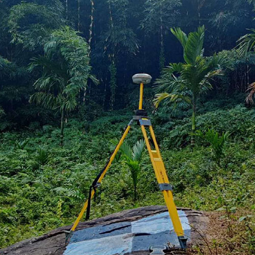
Forest Survey
Forest surveys provide information on the resources available as well as other factors that may have an impact on the nation’s ecological wellbeing. Regular surveying enables governments
and other relevant bodies to identify trends and decide whether to add more tree cover. A statistical analysis and comparison with earlier surveys are both always beneficial. It also used to gather data on the health of the forest, including information on the different species of trees, their ages, heights, and rates of development, as well as details on diseases and pests that are destroying the forest. Additionally, they aid in monitoring logging operations and trees that have fallen due to wind or poor soil conditions. This kind of survey also aids in gaining an understanding of the local topography, slopes, and soil conditions to ascertain whether they are relevant to the forest and its growth or depletion. outputs.

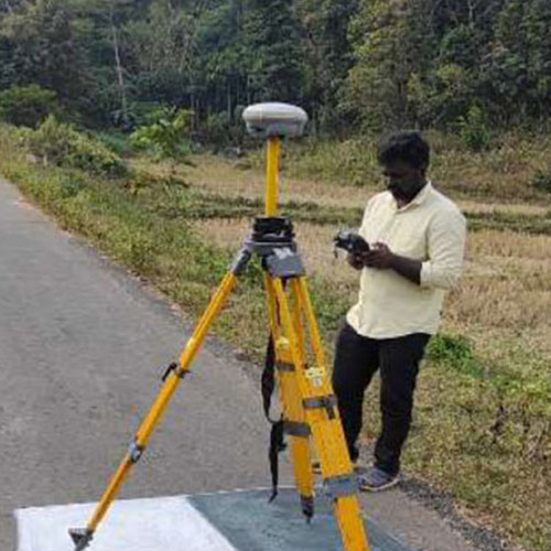
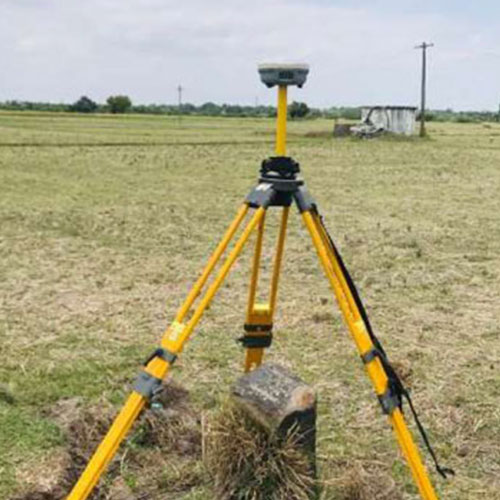
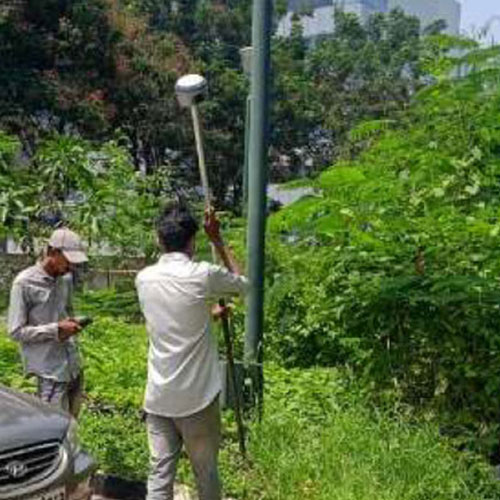
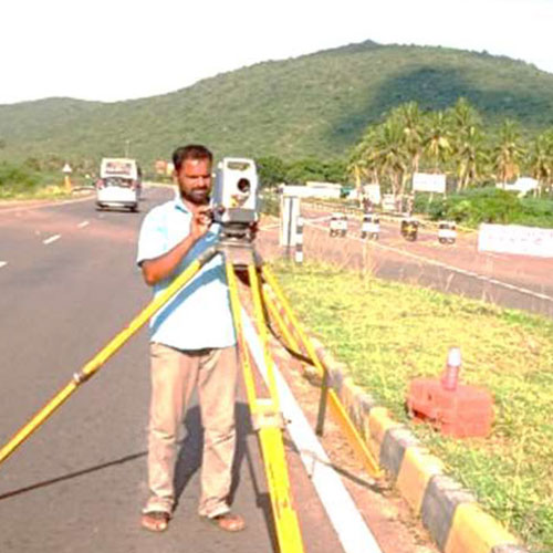
Ground Surveys – ETS/DGPS
We have surveyors who can conduct GPS and DGPS surveys for GIS mapping to provide very
accurate position data. SenseImage surveyors are experienced in using DGPS to achieve precision for primary, secondary, tertiary, and auxiliary locations. Depending on how much time is allotted for each point, these points could be different.
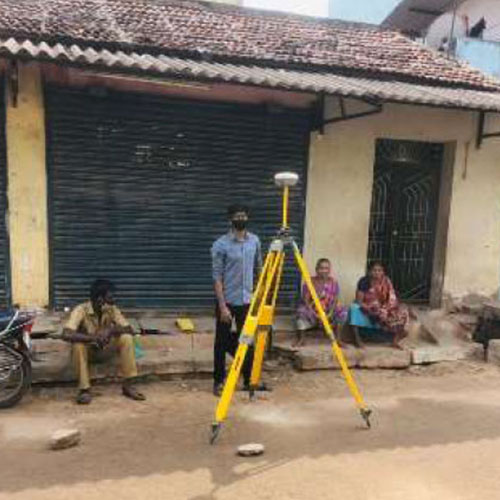
Household Survey
A sample of the households in a population are surveyed using household surveys. This kind of study is highly beneficial for municipal organisations or ULBs when creating development plans, identifying unassessed properties, calculating property taxes, connecting to the water system, registering births and deaths, and more. We provide GIS services that involve digitising household surveys to create a database that contains details on each property, including the landowner, any co-owners, mailing and permanent addresses, the type of house, the year it was built, and its measurements.

Land Surveying
It generally refers to natural or man-made land features such as rivers, streams, lakes, wood, hills, roads, railways, canals, towns, water supply systems, buildings and properties, and so on. The art and science of creating or reestablishing corners, lines, borders, and
monuments of real property (land) using historical evidence, documentation, and current norms of practise is known as land surveying. Along with other related services, land surveying also
covers subdivision planning and design, legal description writing, mapping, construction layout, and accurate measurements of angle, length, area, and volume.
Mine Survey
Mine surveying is an essential component of all phases of mining operations. Mine Survey includes include both surface and underground surveys. It is conducted for the exploration of mineral deposits and to guide tunneling and other operations associated with mining

Plane Surveying
The term “plain surveying” refers to a method of surveying in which the earth’s surface is treated like a plane and the earth’s curvature is disregarded. A line connecting any two stations is regarded as straight in this type of surveying. Any triangle formed by three points is thought of as being on a plane, and its angles are thought of as being simple.
- Boundary Surveys
- Site Planning Surveys
- Location Surveys
POI Survey
The process of plotting important or popular locations on a map to see their geographical proximity to one another is known as POI mapping. It is used in location based marketing and store site planning to determine where advertisements and stores will attract foot traffic or face competition from other POIs.

Slum and Socio-Economic Survey
With the goal of providing basic amenities, GISC has been given slum survey projects under the Rajiv Awas Yojna. We provided the aforementioned services, they are
- a) Slum survey of each slum property, including questionnaire completion and a biometric survey.
- b) Each slum was assigned a unique slum cod.
- c) Slum mapping using GIS.
- d) Creation of a web-enabled management information system.
- e) A socioeconomic survey of those who use the service.
- e) A socioeconomic survey of those who use the service.
- f) DPR planning.
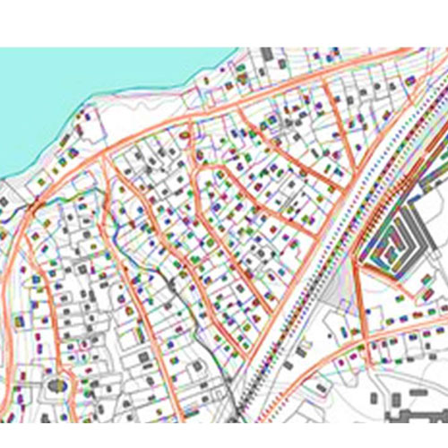
Topographical Surveys
A topographic survey is a 3D illustration of a piece of land that demonstrates elevational variations. Topographic surveys are extremely helpful for comprehending a property because they display all of the land’s surface features, both man-made and natural. Rivers, mountains, fences, structures, valleys, trees, utilities, and contours are examples of land characteristics.
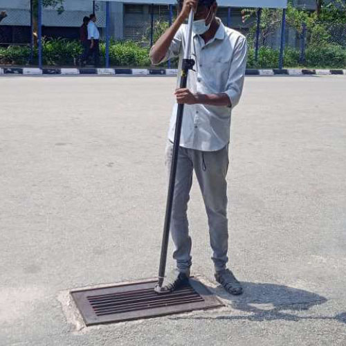
Utility Survey
The utility survey is concerned with the mapping and descriptions of overhead and underground service lines such as ducts, cables, and pipes, as well as associated elements such as manholes, poles, catch basins, transformers, and hydrants. We are experts in Utility mapping, HT and LT consumer indexing, asset
mapping, painting, and billing for electrical networking, followed by physical verification using GPS and DGPS. Our skilled engineers are well-versed in conducting GPS and DGPS surveys to collect attributes based on project specifications.