REMOTE SENSING
Remote sensing is one of the methods commonly used for collecting physical data to be integrated into GIS. Remote sensors collect data from objects on the earth without any direct contact.
Remote sensing spatial data may significantly aid in the identification of sensitive regions, the improvement of mapping, and the better understanding of hazards and their complex relationships. The key benefits to be discussed are the spatially expanding information collecting, the building of data bases, and the monitoring capabilities.
The following verticals include remote sensing services:
- Agricultural mapping
- Environmental impact assessment mapping
- Forest mapping
- Imagery interpretation
- Landuse/Landcover classification & Change detection
- Supervised and UnSupervised Classification
- Slope analysis
- Mining and geology mapping
- Watershed management

Mapping Services
Cadastral Mapping – We have a dedicated team for mapping and integrating the boundaries and ownership of land inside a certain area, as well as what the land can be used for (e.g., residential, or not, national park, etc.) and possibly the placement and shape of buildings. This cadastral can also be used to collect land taxes. Cadastral mapping services additionally allow users to examine additional information such as survey district names, unique identification numbers for parcels, existing structure locations, street names, border measurements, and references to previous maps.
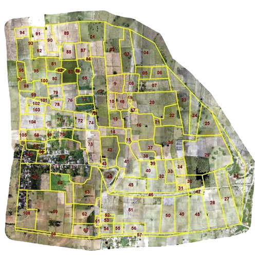

Parcel mapping – Parcel Mapping is a process in which land parcels are created for efficient and effective land management. Parcel mapping service generates maps, created from base maps, with polygons that have details about the ownership of properties and other related information. The use of parcel mapping services also aids in municipal planning, administration, and urban development through the use of intelligent parcel mapping techniques, which have the capacity to recover analytical data that is critical for improving the operational capabilities of government organisations. The benefit of parcel mapping services is that they allow you to replace the time-consuming process of keeping data on paper maps with digital maps, which results in better decision-making, data sharing, and a decrease in operating expenses and time.
Utility Mapping – We have a utility mapping expert who can design, draught, and prepare power supply lines from a power plant.
The main areas we focus in the GIS for electricity sector are:
- Formation of route alignment
- preparation of LT, HT lines for asset mappin
- Network Mapping
- Distribution Network Design
- Consumer Indexing
- Site Suitable Studies
- Pole Loading Analysis
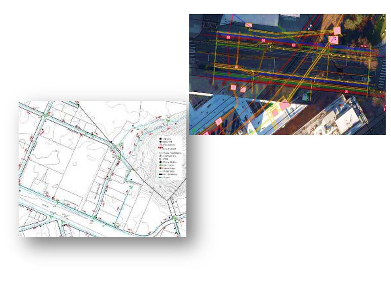

Corridor Mapping – We provide a corridor mapping using a helicopter bound LiDAR sensor by flying at lower altitude. A corridor may be highway, railway
or oil and gas pipe line. The data are useful in planning the corridor and during execution of work and later for monitoring the deflections, possible areas of repair etc. High density of data facilitates generation of a record of the assets of the corridor.
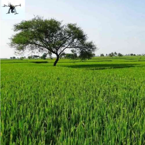
Agricultural Mapping: with Drones – We provide aerial agricultural mapping services to monitor crop health, productivity, and quality. The end result is lower operating costs, better crop quality, and a higher yield rate. Drone-based mapping offers very high spatial resolution mapping of agricultural areas, allowing for monitoring of even minute vegetation anomalies inside the parcel. For example, unequal germination and development caused by drought, seedling loss from flooding and anoxia, disease outbreak, pest invasion, imbalanced nutrient availability and uptake, and overwintering damages can all contribute to uneven growth of plant stands. Drones can also make it easier to monitor variances in field parcels’ capacities for production at the farm level by keeping an eye on the variation of vegetation within a parcel. When estimating yield gaps (i.e., the difference between potential and achieved yields) of fields from the landscape up to agricultural fields, drones may also provide extra high-resolution information that is useful for the interpretation of satellite data.

The following ways our products and services can be of assistance
- Crop mapping
- Soil mapping
- Land use / Land cover
- Drought, flood mapping
- Forestry mapping
- Agricultural mapping
- Erosion identification
- Vegetation covers
- Crop models
- Pesticide management
Landuse and Landcover Mapping – We have a experts for Land Use Land Cover (LULC) maps of an area provide information to help users to understand the current landscape. Land use and land cover mapping is carried out to study the land utilization and future planning and management of land resource. We also prepare Urban land-use mapping for different purposes, such as industrial, residential, institutional and commercial areas. The baseline from which monitoring operations (change detection) can be carried out is established by the identification of land cover. Remote sensing techniques can be used to categorise the many types of land use in a repeatable, practical, and economical manner over huge areas.

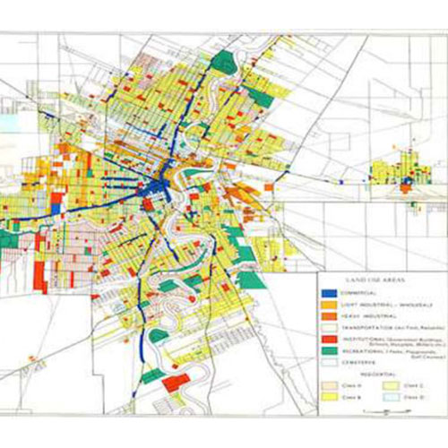
Urban Mapping -We have a GIS enabled urban planning firm, consulting to government sector and private sector. Our urban planning
division offers planning solutions using the latest geospatial tools and techniques to meet the basic development requirements of government agencies and urban local bodies. We Provide consultancy services to the central and state governments and various local bodies. We have expertise in real estate advisory, land feasibility, masterplan, town plan, city plan, or rural plan, zoning regulation and bye laws Urban planning.
Image classification and acreage estimation (Fuzzy logic and AI) – Digital image classification uses the spectral information represented by the digital numbers in one or more spectral bands, and attempts to classify each individual pixel based on this spectral information. This type of classification done by using artificial intelligence, fuzzy logic and neural network. In either case, the objective is to assign all pixels in the image to particular classes or themes (e.g., water, sandal wood, deciduous forest, corn, wheat, etc.).