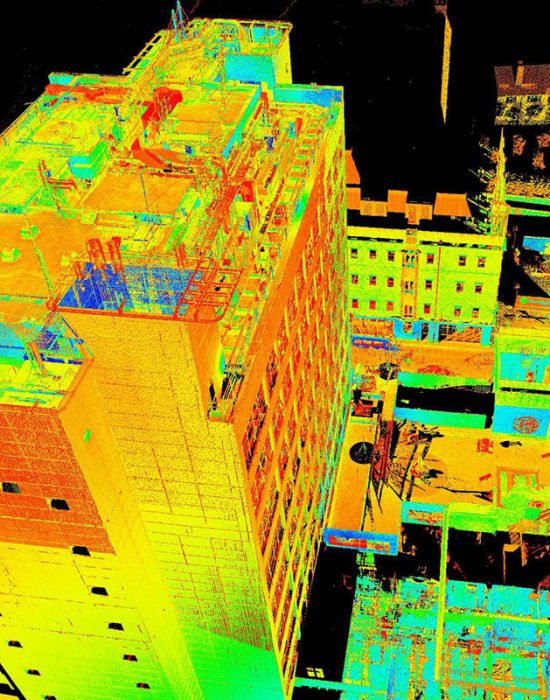
laser scanning Drones
Below are listed just a few applications of this powerful technology
SenseImage Technologies has the unique capability to extract engineering grade Digital Terrain Model (DTM) from Digital Surface Models (DSM) making it possible to have buildings, trees, vehicles, fences, vegetation and other ‘off-terrain’ surface features removed from elevation data to produce an engineering ready ‘bare-earth’ or ‘ground’ surface which are RTK referenced to under 5cm vertical and 3cm horizontal accuracy. Digital Topographic Information (DSM, DTM & Contour Mapping), Vegetation Health Mapping and Statistical Comparisons of Plant Health, Flow Modelling for Drainage or Spills, Spectral Mapping (Contaminant Identification, Tree Counts, Crown Areas, …), Volume, and Distance & Area Measurements for Compliance.


Our Supplemental
Products


☆☆☆☆☆
Entrepreneur Read More
We developed great partnerships with SenseImage Technologies and their dedication towards providing drone service is evident in all aspects. We appreciate their attention to detail and technical approach in getting accurate data in the inspection.

☆☆☆☆☆
Entrepreneur Read More
Hey guys, I just wanted to share a quick note about SenseImage Technologies. The work culture and business you guys maintain, is well mannered with all deliverables provided on time. You guys make sure that the target is achieved within stipulated time with the promised quality of data.
Previous
Next
CLIENTS FEEDBACK
Talent You Can Trust
our clients


