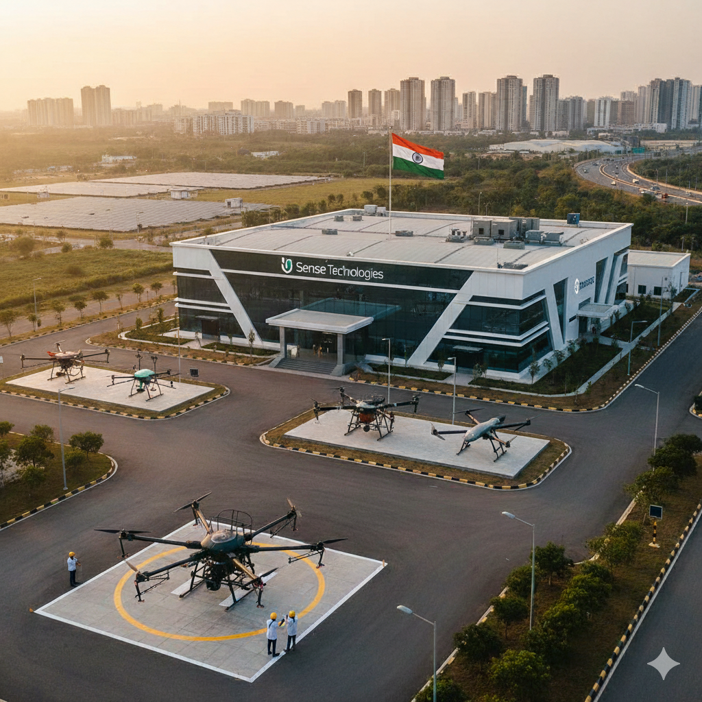
SenseImage – Leading Drone Manufacturing company in India
SenseImage is a drone manufacturer in India focused on building reliable, high‑performance UAV systems for real‑world industrial applications. Our in‑house team of engineers, avionics experts, and software developers design and manufacture drones that meet Indian regulatory standards and demanding field conditions.
From concept and design to prototyping, testing, and deployment, SenseImage delivers end‑to‑end drone solutions tailored to the needs of enterprises, government organisations, and specialised agencies across the country.
Why Choose SenseImage as Your Drone Manufacturing Partner
Choosing the right drone manufacturer in India is critical for safety, accuracy, and long‑term ROI. SenseImage stands out through a combination of engineering expertise, domain understanding, and implementation support.
- Made for Indian conditions: Our drones are tested for heat, dust, and challenging terrains commonly found across India’s agricultural, industrial, and border regions.
- Compliance and reliability: We follow DGCA guidelines, quality checks, and robust testing procedures to ensure safe and consistent UAV performance.
- Customisable platforms: Airframes, payloads, sensors, and software workflows can be configured for specific use cases like mapping, surveillance, or delivery.
- End‑to‑end support: We provide training, maintenance, upgrades, and post‑deployment analytics support so teams can operate our drones with confidence.
Drone Solutions We Offer Across India
SenseImage designs and manufactures specialised drone platforms for multiple industries, helping organisations improve efficiency, reduce risk, and gain better data‑driven insights.
Agriculture Drone Solutions
- Our agriculture drones are built to support precision farming, helping growers and agri‑companies optimise inputs and improve yields.
- High‑resolution aerial mapping for crop health monitoring, NDVI analysis, and field planning.
- Spray drones for accurate fertiliser, pesticide, and nutrient application, reducing wastage and labour costs.
- Data integration with farm management systems for better decision‑making and reporting.
Defense and Security Drone Systems
SenseImage manufactures rugged UAVs for surveillance, reconnaissance, and tactical support in defense and homeland security environments.
- Long‑endurance drones equipped with day/night cameras, thermal sensors, and secure data links.
- Real‑time situational awareness to support border management, critical infrastructure security, and emergency response.
- Custom payload integration for mission‑specific requirements and interoperability with existing systems.
Logistics and Delivery Drones
Our logistics‑focused drone platforms are engineered to support the future of aerial delivery in India.
- Payload‑optimised drones for delivering critical items such as medical supplies, documents, and small goods.
- Route‑planning and tracking systems to ensure safe, compliant, and efficient operations in designated corridors.
- Scalable solutions for enterprises exploring last‑mile or intra‑facility drone delivery pilots.
Industrial and Infrastructure Drones
SenseImage also serves industrial, infrastructure, and utilities clients with drones built for inspection and monitoring.
- Aerial inspection of power lines, solar farms, wind turbines, oil and gas assets, and industrial plants.
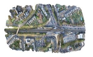
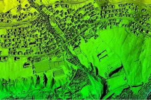
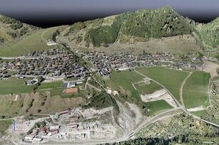
- High‑accuracy 2D/3D mapping, volumetric measurements, and digital twins for construction and mining projects.
- Reduced downtime and safer inspections by replacing manual, high‑risk field operations with UAV‑based workflows.
Nationwide Presence and Regional Expertise
As a growing drone manufacturer in India, SenseImage supports clients across multiple states through a mix of central production, regional partners, and on‑site deployment teams.
Our strong presence in South India, including dedicated support for organisations looking for a specialised Drone Manufacturer in Chennai, helps us respond faster with local training, deployment, and service assistance. You can learn more about our Chennai‑focused capabilities here: Drone Manufacturer in Chennai.
Whether you are a government department, enterprise, startup, or system integrator, SenseImage provides scalable UAV platforms and solutions to support your operations anywhere in India.
FAQ
1, What makes SenseImage stand out as a drone manufacturing company in India?
SenseImage distinguishes itself through engineering expertise, understanding of Indian conditions, compliance with regulations, customizable platforms, and comprehensive support services.
2, What industries does SenseImage provide drone solutions for?
SenseImage offers drone solutions for agriculture, defense, security, logistics, delivery, industrial inspection, and infrastructure monitoring.
3, How are SenseImage’s drones tailored for Indian conditions?
Their drones are tested for heat, dust, and challenging terrains typical across India’s agricultural, industrial, and border regions, ensuring reliable performance.
4, What types of deliverables does SenseImage provide with their drone services?
SenseImage provides various deliverables including orthomosaic maps, 3D point clouds, digital surface and terrain models, contour maps, and textured 3D meshes.
5, Does SenseImage offer support after drone deployment?
Yes, they provide end-to-end support including training, maintenance, upgrades, and post-deployment analytics to ensure optimal operation.